BLIZZARD WARNING Issued in Iowa
**Updated 5:30 am 2/4***
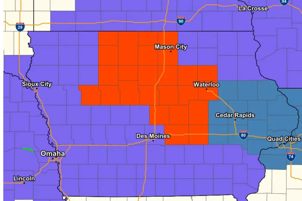
The National Weather Service in Des Moines has issued a BLIZZARD WARNING from 9 AM Thursday to 6 AM Friday for portions of Iowa including the cities of Waterloo, Marshalltown, Ames, Mason City, and Fort Dodge.
Temperatures look to remain around 35* through the early morning hours of Thursday, but then drop to around 20 by late-Thursday afternoon, to the single digits by Friday morning. Wind chills will fall below zero by Thursday evening.
As the temperatures plummet on Thursday, wet or slushy roads may flash freeze and quickly become very slippery.
As the rain turns to snow, 40+ MPH wind gusts will create widespread blowing snow and blizzard conditions at times.
Definition of a BLIZZARD: Blowing and/or falling snow with winds of at least 35 mph, reducing visibilities to a quarter of a mile or less for at least three hours.
Since 2011, the NWS in Des Moines has issued an average of 1.9 Blizzard Warnings per calendar year for their 51 county coverage area. (a total of 19). There's now been THREE blizzard warnings issued since December 2020.
TIPS: Here's how you can prepare for power outages
More From AM 950 KOEL